- Name of street and street number: 237 Choi Hung Road
- District: Tsz Wan Shan, Diamond Hill and San Po Kong
- Website address#: www.housingauthority.gov.hk/hos/2020/KaiCheung
- Appointed architect: Chief Architect (5), Housing Department
- Building contractor: Yau Lee Construction Company Limited
- Firm(s) of solicitors acting for the vendor: W. K. To & Co.
- An occupation document (i.e. Occupation Permit) of Kai Cheung Court was obtained on 31 May 2023
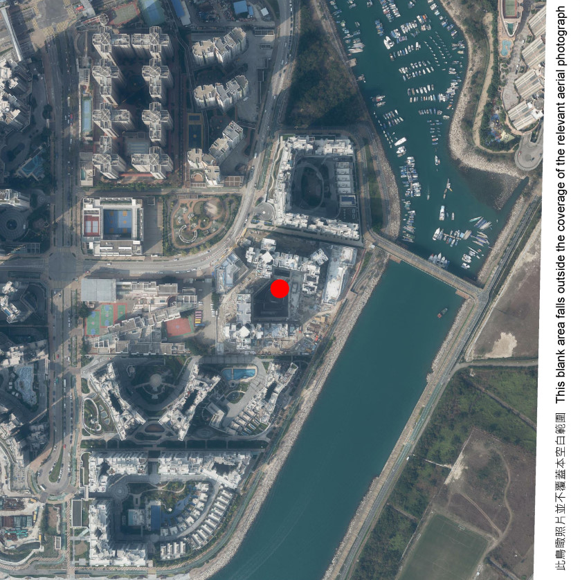
Yung Ming Court - Aerial Photograph of the Development

Yung Ming Court
Adopted from part of the aerial photograph taken by the Survey and Mapping Office of the Lands Department at a flying height of 6,900 feet, photo no. E091184C, dated 20 February 2020.
Survey and Mapping Office, Lands Department, The Government of the Hong Kong SAR © Copyright reserved - reproduction by permission only

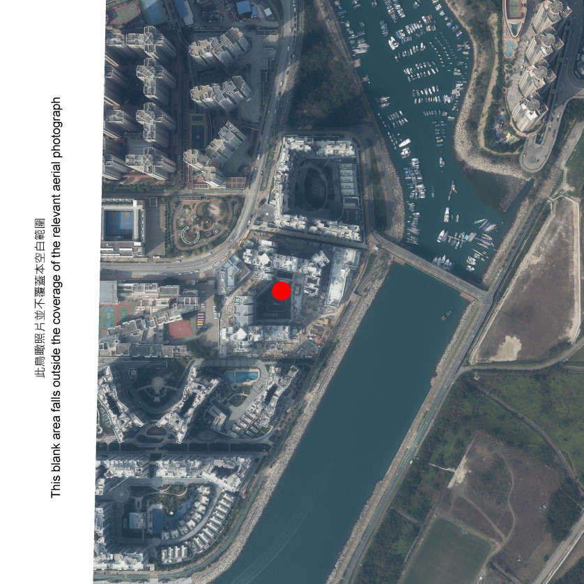
Yung Ming Court
Adopted from part of the aerial photograph taken by the Survey and Mapping Office of the Lands Department at a flying height of 6,900 feet, photo no. E091183C, dated 20 February 2020.
Survey and Mapping Office, Lands Department, The Government of the Hong Kong SAR © Copyright reserved - reproduction by permission only
Notes:
- Copy of the aerial photographs of the Development is available for free inspection during opening hours at the HA Customer Service Centre.
- The aerial photographs may show more than the area required under the Residential Properties (First-hand Sales) Ordinance due to the technical reason that the boundary of the Development is irregular.